


The AIM COST ROAD MAP
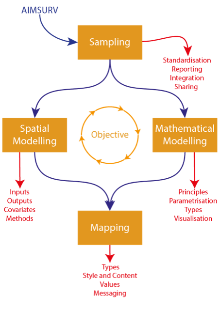
Since 2018, Aedes Invasive Mosquito (AIM) COST Action (Project ID: CA17108) has promoted European networking and collaboration between the researchers, public health professional, and the public so as to increase harmonisation, preparedness, and capacity for surveillance and control of AIM vector species. One of its defined outputs is Integrating surveillance data analysis, spatial modelling & mapping to ensure the quality and applicability of future technical outputs at the European level. This document (Link to pdf) addresses this task by setting out a Roadmap of activities from surveillance to establish vector distributions to aid vector control for mitigation of nuisance and disease risk through to the production of maps needed to communicate the outputs to a range of stakeholder, as well as the modelling needed to fill the gaps in surveillance outputs to make the maps complete.
The document fulfills the formal requirements of Task 1.2: Integrating surveillance data analysis, spatial modelling & mapping to ensure the quality and applicability of future technical outputs at the European level; Deliverable 3: Synthesised feedback with recommendations for customising surveillance, control, and modelling guidelines; and Deliverable 4: Guidelines for customisation of mapped outputs.
The Roadmap is not intended to be a comprehensive guide to all the many complex procedures and specialist methodologies that contribute to this chain of activities. Rather it is intended to be an extended aide memoire for a wide range of non-specialist professionals, providing recommendations for best practice for each of the major components. Following consultation with the Network members at the 2023 Annual Meeting in Rome 2023, the Roadmap also summarises the steps that need to be implemented in when an invasive mosquito species is first recorded in a new region.